Who Are We & What Are We Building
Welcome to our first post on the Quantiscan blog. To set the stage early, we are a small team from Montana (and Oregon, but soon to just be Montana.) We founded Quantiscan because we’re passionate about technology, genuinely believe in the power of good software, and we love to build (especially when it comes to LiDAR).
Our Background
Prior to this, we spent time building a company called Flight Evolved. Our goal was to innovate in the electric utility space with both drones and LiDAR. We ended up operating drones, helicopters, airplanes, and what feels like every type of remote sensing in between. We were privileged to work with some very tech progressive utilities on both the West and East Coast. We also got to pioneer some pretty interesting projects with Major League Baseball and ESPN leveraging automotive LiDAR sensors to track players, object velocities, and other data in broadcast environments.
When we first stepped into the LiDAR world, we noticed that while the hardware and sensors were evolving, the software and processing workflows were still operating on legacy systems built decades ago. Even as promises of “Ai-based classifications” emerged, the juice was never worth the squeeze. And as the dirty secret has always been, people just ship data to click-farms in India for manual classifications and feature extraction. We still see tremendous value in AI tooling for LiDAR (and classification), but in the world of electric utilities, getting 90% of the core electrical features was awkwardly not very helpful (I’ll explain this more below).
Fast forward a few years, and the problem still persists. Today, there are promising developments in the software space. Yet many companies are focusing on cloud-only solutions which only serve to skyrocket storage (and licensing) costs while adding little for efficiency gains.
In every corner of the industry, there’s a clear need for something better.
Our Vision: Getting to the “End State” Faster
Our goal with Quantiscan is to get to the end product faster. To us, LiDAR is not the destination—it’s the foundation that informs decisions. Everyone who has worked in the electric utility industry knows that all processes inevitably are a race to a PDF. Whether it’s an engineering drawing for a construction crew or a vegetation report for tree trimmers, the ultimate goal is actionable information. We believe the process to get to that information should be as streamlined and efficient as possible. We need to cut through all the bloat (manual classifications) that’s become industry standard.
We’re committed to getting to that “end state” more quickly and effectively. This means extracting the meaningful insights from data and seamlessly exporting them into the workflows you rely on every day. Our approach is not about throwing fancy Ai terms into the mix just because they’re trendy; it’s about smart technology that genuinely makes your job easier.
Performance & UX
Let’s talk about the software itself. We’ve all used clunky, menu-heavy programs that seem best fit for Windows 95. Our vision for Quantiscan is different: we’re building a modern platform that boasts an intuitive interface, lightning-fast load speeds, and the option to use either local or cloud-based data storage. We don’t want you locked into endless cloud fees or an overly complicated workflow. Instead, we want our software to feel like a natural extension of your expertise—a tool that empowers you rather than complicates your day.
Quantiscan is built using many web technologies, but as a desktop application. This allows us to leverage the latest in web technologies, while still providing a native application experience. Most importantly, point clouds can be streamed from the cloud or locally on device. By using point cloud streaming technology locally, that means virtually instant load times for even the largest point clouds. In addition, there are no cloud storage fees, upload/download issues, or cloud-based processing. Quantiscan is designed to be another tool in your toolbox, not a replacement for your existing software. Our goal is not to replace Terrasolid, PLS-CADD, or any other existing software. These legacy applications have incredible value and it is not in our best interest to reinvent the wheel. However, we recognized certain gaps in the existing software that we believe Quantiscan can address.
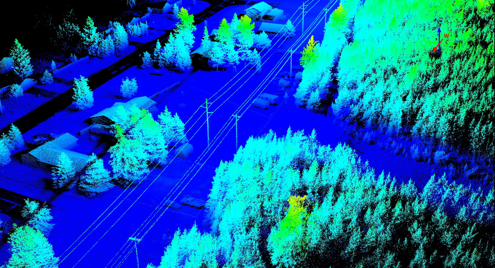
Once the basic architecuture of Quantiscan was complete, we focused on the most common workflows in the electric utility industry. From our previous experience, we noted how laborious and painful the LiDAR processing pipeline was. Most of it was based on expectations and “this is just the way we have always done it”. A project is acquired, it is calibrated, classified, and feature extracted. For larger projects, this can take months. The cringe-worthy part is seeing how much time and money was spent on manual classification. AI based classification (at the time of writing) cannot extract distribution level features. Think poles, crossarms, guy wires, service wires, telecom… then all the synthetic points on top of that (guy wire attachments, crossarm endpoints, conductor attachments, etc). Then you take all these manual classifications to generate a method-1, method-4 or just vectors for veg analysis. Our question was, why not just skip the manual classification step and go straight to the vectors? Then with the vectors, we can generate all those same classifications in a far more accurate way.
So, that is what we did. We created a platform in which users can generate vectors directly from raw point cloud data. This is incredibly fast, accurate, and efficient. We are not the first to market with this technology, but we are the first to market with this technology in a way that is performant, user friendly, local first, secure (all data is on your servers), and vendor/utility agnostic. We wanted a platform in which you could natively view and edit LAZ point clouds with full 1.4 0-255 classification support and even store utility specific classification schemas. There is no special tiling or cloud processing. Just raw point cloud data thanks to COPC .laz. So if you have a .laz point cloud, you can use Quantiscan.
What’s Next? A Community-Driven Approach
Throughout 2025, we’re on a mission to build a software platform that’s both incredibly performant and efficient. We’re not in a rush to hit the market with a half-baked product. Instead, we are looking for partners to join us in refining the tools and help shape the future of the platform.
Our goal is to foster a community where your insights directly shape the evolution of our platform. It’s about building trust, sharing a passion for technology, and ensuring that our software genuinely serves the needs of those who rely on it every day.
Eventually we will figure out a monetization model, but not until both we and our users deem it is worth it.
We’re just getting started, and we couldn’t be more excited about the road ahead.
Thanks for reading, and stay tuned for future updates!
Also… feel free to sign up for our waitlist to get added to the Alpha release.