Aura Project Dashboard
View and manage all your remote sensing data in one place.
Organize your geospatial data in one place. Create projects, share data with your team, process in a live environment.
Get Started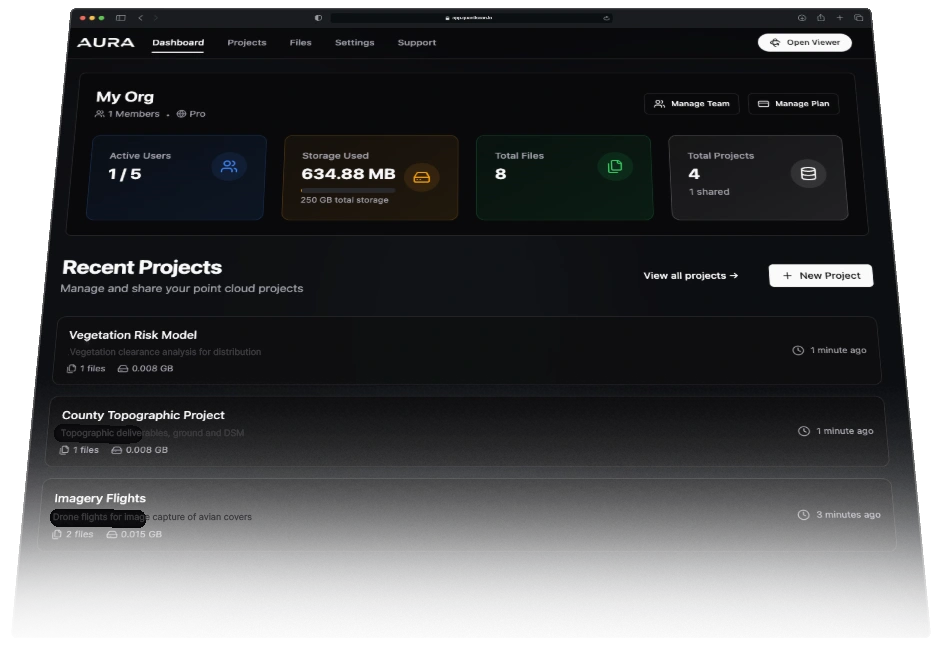
 Aura Project Dashboard
 Organize your geospatial data in one place.
Aura is a full suite of tools for managing all your geospatial project data. From LiDAR processing, vectorizing, topographic deliverables, even imagery and PDFs. Organize, share, and collaborate on your projects with ease.
Intuitive data management tools for geospatial experts. With support for multiple file types you can create projects, manage deliverables, and collaborate with your team.
Your geospatial management toolkit
Generate final deliverables faster. Share directly with your clients for viewing and final downloads.

Universal File Compatibility
Import and manage all your geospatial data in one place. Seamlessly work with LiDAR, drone imagery, CAD files, shapefiles, and orthophotos without conversion headaches.

Real-Time Team Collaboration
Work together simultaneously on projects without version conflicts. Share views, markup data, and coordinate workflows across departments and external partners.

Enterprise Data Security
Protect sensitive geospatial data with our hybrid processing approach. Process critical information locally behind your firewall, with flexible control over what data leaves your network.

Branded Deliverable Portal
Upload your logo to your Aura dashboard and share your deliverables with your clients. Completely white-labeled and customizable to your company.

Hybrid Storage
Get the perfect balance of security and accessibility. Process locally for speed and privacy, then selectively share via cloud when needed—all without expensive server costs.

Simple License Management
Invite users, check out licenses, and manage your team all in one place. Don't pay for extra licenses you don't need!